Northeast Tennessee Waterfalls

A blog dedicated to Tennessee waterfalls in the Mountain Empire. There will be a few from Virginia & North Carolina too.

Monday, May 30, 2005

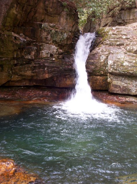
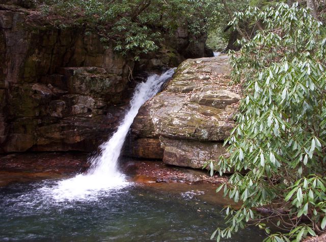
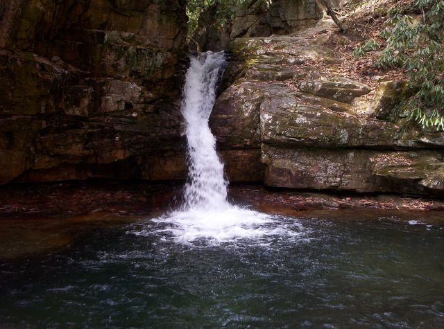
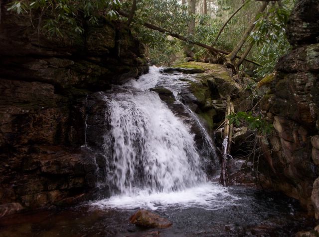
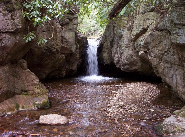
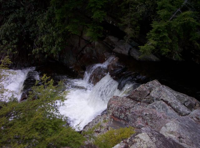
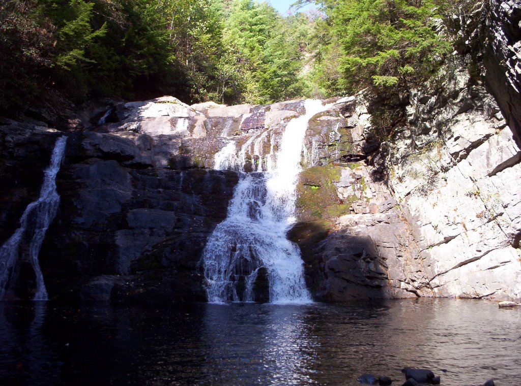
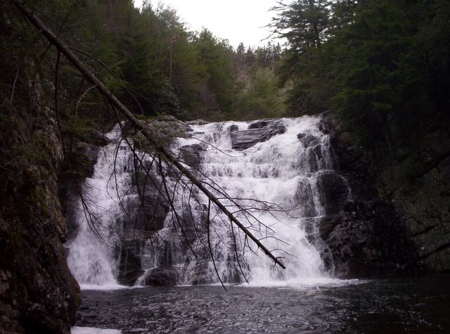
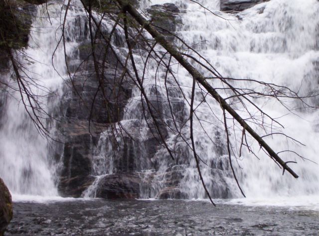
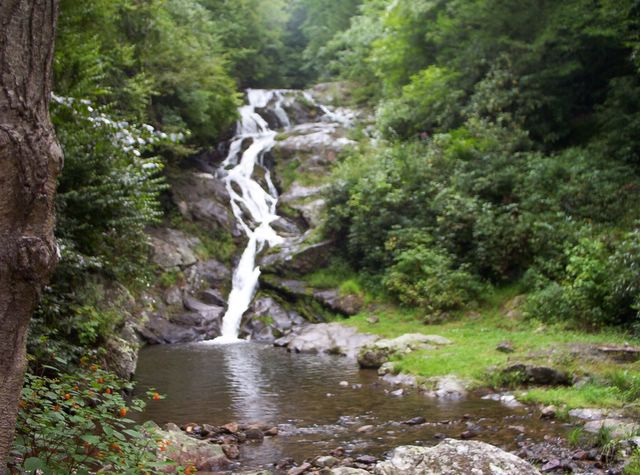
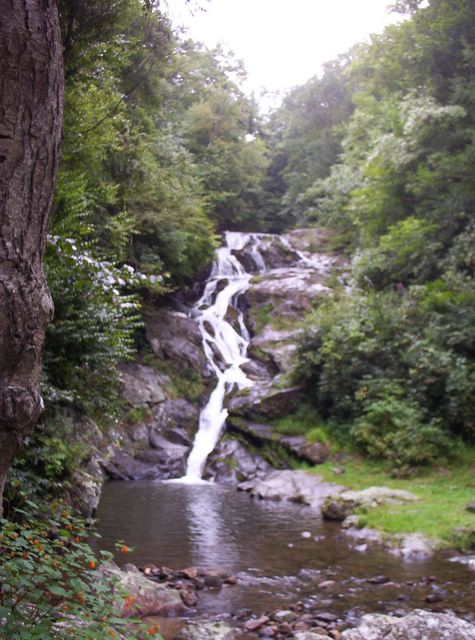
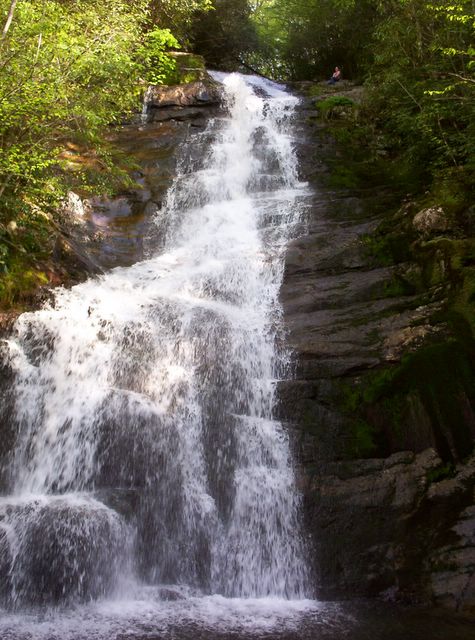
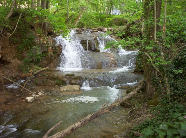
Millstone Creek Falls


This waterfall is located in Washington County, near Unicoi County. It is on private property.

DIRECTIONS: Take exit 18 off of Interstate 26 and proceed westward on state road 81 toward Jonesborough. Drive 4 miles to Arnold Road, continuing straight ahead instead of cross the Nolichucky River on state road 81. Drive 0.9 miles on Arnold Road to an unsigned turnout south of Millstone Creek, on the left side of Arnold Road, adjoining the Nolichucky River. You will pass one or two previous turnouts before you get to this one. There is a small footpath across the street from the turnout. The falls are about 150 yards up the path, in someone's back yard.

Tuesday, May 10, 2005

Blue Hole (Falls)


This is Blue Hole Falls in Carter County. Many just call it Blue Hole. I think you can see why.

DIRECTIONS: Starting at the junction of state road 91 and U.S. 321 in Elizabethton, drive east on 91 for 10 miles. Turn left (north) on Panhandle Road at the national forest sign for blue hole. Drive 0.9 miles to the parking area. The trail to the right leads 0.1 miles down wooden steps to the base of the main falls.

Behind Blue Hole


These falls are behind Blue Hole Falls.

This is the upper falls that feeds the main falls at Blue Hole.

On the way to Laurel Falls


This is a small set of falls before you get to Laurel Falls. There are two or three of these along the way, I believe. I also think this is what is known as Upper Laurel Falls.

Laurel Falls

Here are some decent pics of the mighty Laurel Falls in Carter County. She is a beauty.

DIRECTIONS: Drive 0.8 miles east of the town of Hampton on U.S. 321. Turn at Dennis Cove Road, by the brown national forest campground sign. Dennis Cove Camp is 4.8 miles up the steep, winding road. However, 0.8 miles west of the camp, or 4 miles from U.S. 321, is the small parking area for the Appalachian Trail. Follow the white rectangle blazed trail north for 1.3 miles. You will cross Laurel Fork on a footbridge, and the last 0.3 miles are pretty steep.


Spivey Falls


This is one of the four Spivey Falls in Unicoi County. It is practically someone's back yard. The pics were taken in a light rain and they are not the best. Hopefully I will go back and take better ones. There is an upper falls, as well as two other, smaller falls, each of which I have not been to yet.

DIRECTIONS: Take exit 12 off of Interstate 26 at Temple Hill Road. Continue southward on U.S. 19W for 1.1 miles. Turn left, staying on 19W and go 3 miles to an unmarked paved road on the right. This narrow road will take you to the waterfall.

DIRECTIONS (to upper Spivey Falls, not pictured): Take exit 12 off of Interstate 26 at Temple Hill Road. Continue southward on U.S. 19W for 1.1 miles. Turn left, staying on 19W and go 4 miles to an undesignated turnout on the right side of the road. Right past the turnout is a driveway and a small sign disignating the trailhead to the falls. The path includes wooden and stone steps most of the way.

Red Fork Falls


This is Red Fork Falls in Unicoi County, not too far from Beauty Spot on Unaka Mtn.

DIRECTIONS: Take exit 23 off of Interstate 26. Turn south (right) at the town of Unicoi. Drive 0.8 miles to state road 107. Turn left (eastward) and go 7.6 miles, then turn right on Unaka Mountain Road. After 0.7 miles the road turns to gravel. Drive another 0.5 miles and park at an undesignated turnout by a 4WD road. Hike down this road. You'll reach the creek quickly and have to ford it, and then do it again in 100 feet. Follow the path to the top of the falls, though the path is not very clear in the beginning. A fairly steep short path is to the left of the falls and takes you to the base. Don't go to the brink of the falls. Many have and many have died. There are also lots of smaller cascades above and below these falls.

Boone's Creek Falls


This used to be a waterfall, as you can see from the first photo. Daniel Boone hid from indians under it. It is located in Boone's Creek, just north of Johnson City.

DIRECTIONS: Take exit 38 on Interstate 26. Turn right if you are coming from Johnson City. Turn left if you are coming from Gray. Drive 0.8 miles and turn right before you get to the four way stop light. Drive 0.3 miles to the unsigned turnout just before the small bridge that crosses the creek. A lawn mowing company has recently located here. Walk on the bridge to view what is left of the falls.

Elk Falls


Here are some pics of Elk Falls just across the Tenn. state line into North Carolina.

DIRECTIONS: Drive on U.S. 19E from Tennessee into North Carolina. Go 0.9 miles after you cross the state line. Turn left at sign for the falls. Then turn left again in a quick 0.3 miles. You will then drive 4.2 miles, mostly slow and winding, to a turnout and parking area. Follow the trail to the base of the falls.

Fall Branch Falls


Here are pictures of Fall Branch Falls, just off of Hwy. 93. This is near the Washington/Sullivan County line. I have also included a picture of Fall Brach just above the falls. It is quite a steep hike up to there, and possibly not worth it. It is also someone's back yard, right off of Hwy. 93.

DIRECTIONS: Drive to Exit 50 on Interstate 81. Turn right if you are coming from Johnson City and turn left if you are coming from Morristown. Drive 2.9 miles through the town of Fall Branch on Hwy. 93. Turn left on Baileyton Rd. (also known as Horton Hwy.). The falls are 0.8 miles later, on your left in a cow field. When I went there was wood pile in the field with a rusty truck on top. I don't think that is moving anytime soon. On the right is a house, close to a barn and these are the people who own the land with the falls. Ask them for permission and then follow the path and creek to the falls.